
Skip to portfolio content
Geospatial Lab DATA & ANALYTICS

GIS & Geospatial Data Coordination

Welcome to my GIS & Geospatial Data Coordination portfolio. I work with geospatial information and coordination to support clearer decisions.

Working with location-based information, mapping workflows, and coordinated data processes to support practical decisions.

“A map becomes meaningful when accurate information helps people make better decisions on the ground.”

— Md Chhafrul Alam Khan

Connect data, location, and practical decisions.

Md Chhafrul Alam KhanGIS Assistant · Project Coordination
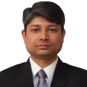
Full-length executive portrait of Md Chhafrul Alam Khan
Md Chhafrul Alam Khan Strategy · Technology · People
ShareFound something useful?

FIELD NOTES / PROFESSIONAL PRACTICE

Inside this portfolio

An overview of experience, professional methods, and real-world context.

Working with location-based information, mapping workflows, and coordinated data processes to support practical decisions.

Professional focus

Geospatial coordination brings together location information, project documentation, operational accuracy, and collaboration among people who use the resulting data.

How I approach this work

  • Organize geospatial files, metadata, naming conventions, and basic quality checks.
  • Coordinate requests, revisions, and documentation among stakeholders.
  • Explain location-linked information with appropriate uncertainty and operational context.

Work and practical context

My professional history includes GIS assistance and office coordination in the Cobra Tedagua Joint Venture context. I present this as project-related technical and administrative experience, without implying authorship of unsupported research or mapping products.

Value and professional perspective

Reliable geospatial work depends on the provenance, currency, and interpretation of data, along with careful communication between field and office activities.

Md Chhafrul Alam Khan · Original portfolio: https://mdchhafrulalamkhan.com/portfolio/gis-and-geospatial-data-coordination/

Public work and references

Related published work and firsthand source material.

LET’S CONNECT THE WORK TO YOUR GOALS

Connect data, location, and practical decisions.

My GIS and project coordination experience informs clear information flows, documentation, and operational teamwork.

SharePass it along

“Nothing is impossible, if you have true wish and knowledge to find, collect, and utilize information.”— Md Chhafrul Alam Khan
This printable portfolio is ready. Use your browser’s Print command and choose Save as PDF to create a PDF document.